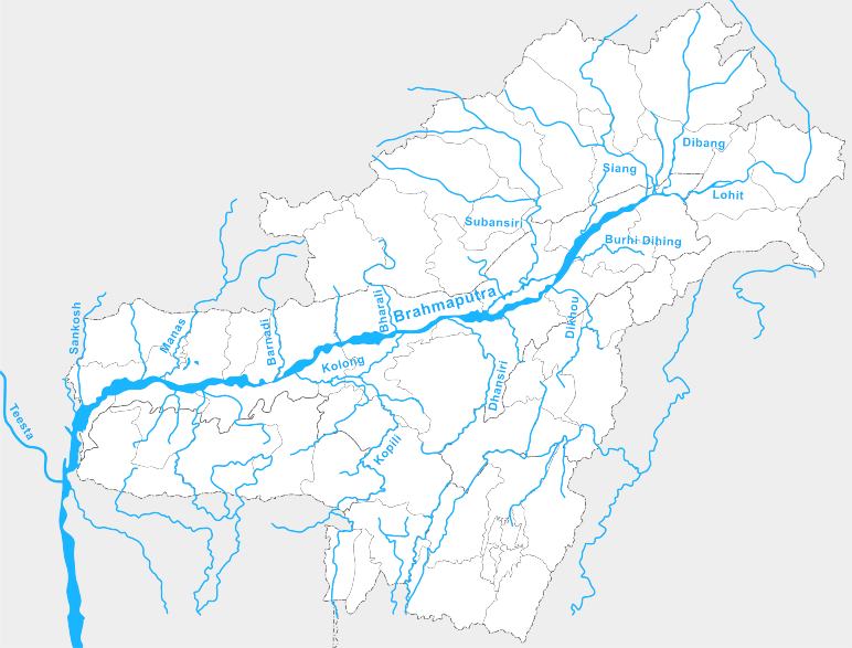
1. The Brahmaputra River has its source in southwest Tibet. The overall length of the Brahmaputra River is approximately 1,800 miles (2,900 km). It is considered as the longest rivers flowing in India.
2. It’s average height is 4,000 meters (13,000 ft), it is also called as the tallest of the important rivers in the world.
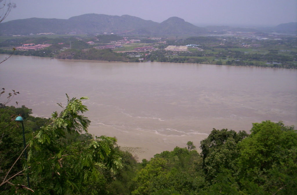
3. The river is named as Tsangpo-Brahmaputra River. On certain occasions, the river is as broad as 10 km (6.2 mi) in Assam.
4. Teesta is one of the important rivers in northeast India . The river is located in the state of Sikkim in India.It is stated to be the lifeline of Sikkim, running for nearly the whole stretch in the state.
5. The Subansiri River is the biggest tributary of the Upper Brahmaputra River. The river is also named as the Gold River. The Subansiri is the lifeline for a large number of people living in Dhemaji and Lakhimpur districts. The river moves down through the green tropical rain-forest in Arunachal Pradesh.
6. Tsang-Po River is also known as Yarlung Zango River. It is one of the major tributaries of the Brahmaputra River. Kayaking is a popular adventure sports activity on the waters of this river.
7. The Jamuna is one of the key tributaries of the Brahmaputra River. It is also one of the three major rivers in Bangladesh.
8. Supplied by the waters of the Brahmaputra and the Ganges, this river system creates the Ganges Delta, which is the biggest river delta in the world.
9. Brahmaputra twists near Mount Namcha Barwa and creates the Yarlung Tsangpo gorge, which is considered as one of the deepest gorges in the world.
Quick Facts:
| Header | Information |
|---|---|
| Countries | China, India, Bangladesh |
| States | Assam, Arunachal Pradesh |
| Autonomous Region | Tibet |
| Branches | Dibang River, Lohit River, Dhansiri River, Kolong River, kameng river, Manas River, Raidak River, Jaldhaka River, Teesta River, Subansiri River |
| City | Guwahati, Dibrugarh, Tezpur |
| Source | Himalayas, Tibet |
| Elevation | 5,210 m (17,093 ft) |
| Coordinates | 30°23’N 82°0’E |
| Length | 3,848 km (2,390 mi) |
| Depth | 38 meters(124 feet) |
| Basin | 712,035 km2 (274,900 sq mi) |
| Discharge | Bay of Bengal19,800 m3/s |
